Satta Pass: The Postcard and the Chokepoint
Before there was a road over the mountain, travelers got past it by running between waves. The stretch was called “parent doesn’t know child, child doesn’t know parent.” Today three of Japan’s main arteries are packed into that same narrow corridor. The view down onto them from the old road above is still called the finest on the Tokaido.
For most of its history, the way past this mountain was to run.
Satta-yama drops straight into Suruga Bay. There was no dry ground at the bottom, nowhere to put a road. For centuries the road was whatever wet rock the sea left uncovered. If you had time, you waited for low tide. If you didn’t, you waited for a wave to pull back. Then you ran. Time it wrong and the sea took you. They called that stretch oyashirazu koshirazu: “parent doesn’t know child, child doesn’t know parent.” Everyone was on their own.
That same strip of shore is still the only flat ground here, and these days it is full. National Route 1, the Tokaido Main Line, and the Tomei Expressway all run through it side by side, crossing over each other in a gap barely wide enough to hold them. The pass above looks down on all of it, with Mount Fuji standing behind. That is the picture.
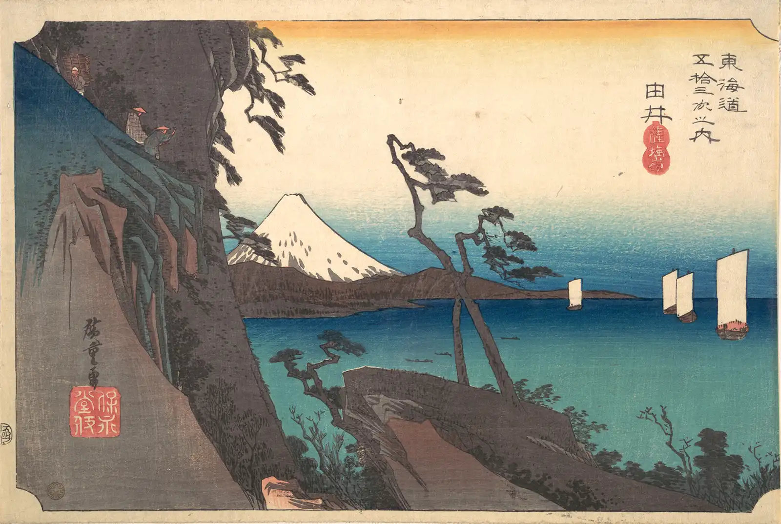
Hiroshige drew this around 1834, for the Fifty-three Stations of the Tokaido. It is called Satta Peak at Yui. A crag rising on the left. Two wind-bent pines. Three small figures at the top of the cliff, one of them leaning out over the drop. Sails on the water, Fuji across the bay. Most of his series is busy with porters and teahouses and weather. But this one is rock and air, and you have to look carefully to find people in it.
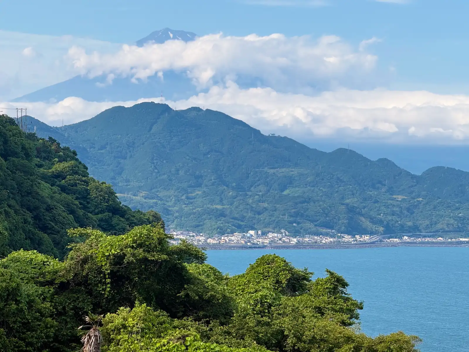
The scene still lines up, more or less. The sails have gone. The pines have gone. The bald hill Hiroshige drew is under fruit trees and scrub. But the shape of the land is the same, and so is the angle on Fuji.
Hiroshige’s travelers are already at the top, looking down. What he doesn’t show you is how they got up there.
The turn off Route 1 is easy to miss, and the highway gives you no reason to look for it. It’s loud and industrial along here, with a lot of trucks. Once you leave it and cross the railway, everything stops, and you are in a narrow lane with old houses close on both sides, moving at walking pace. It feels like a timeslip. This is Nishi-Kurasawa. In the Edo period it was an unofficial rest stop between the post towns, a place where people sat down before taking on the pass. A sign says “Welcome to Satta Pass, 1.3 km,” and points up a slope to the left.
The slope is steep enough that you would happily go up it on all fours, if you weren’t holding a bicycle. I got off and pushed. An e-bike will get you up almost anything (which is the entire reason to own one). Almost. Not with bags on the back. A few dozen meters up it eases off enough to ride again, and from there the road continues the same way: one lane, cut into the side of a very steep hill, drop on your left, hill on your right. With a lot of shade from the trees, thankfully. Two cars can’t pass each other here. Every so often there is a wider spot where one pulls in and waits while the other goes by.
There are houses up here too, well above the village. Actual houses, with gardens, on ground that looks like it is only temporarily attached to the mountain. Makes you wonder, how do they stay up in an earthquake?
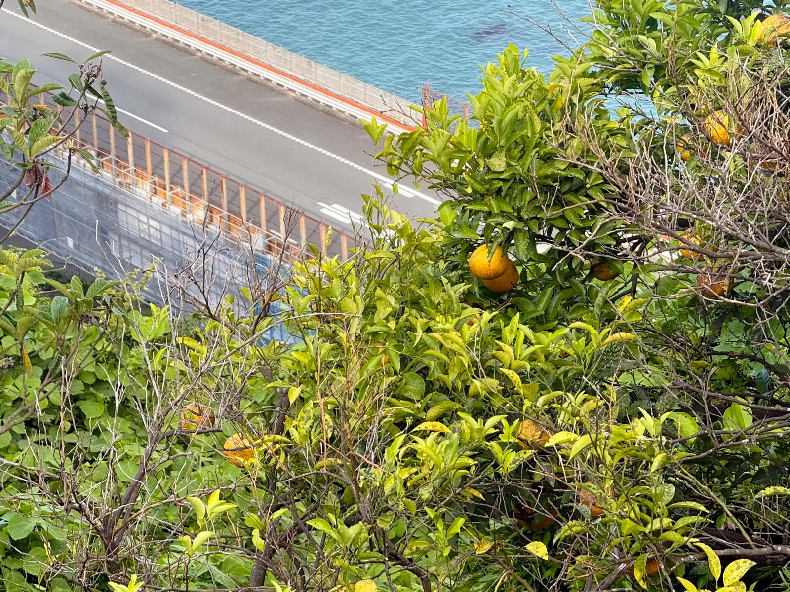
The fruit trees on the slope are loquats, as it turns out. I thought they were oranges the whole way up. There is citrus here too, so it is an easy mistake, but the ones with clusters of orange fruit at the tips of the branches are biwa. Kurasawa loquats, a Yui specialty, grown without pesticide, and every single fruit bagged by hand by a grower standing in the tree. They are picked over two or three weeks, starting in early June. There are never many, and the growers are getting old, so locally they get called a “phantom fruit.” I rode past them all the way up and ate not one, which still bugs me.
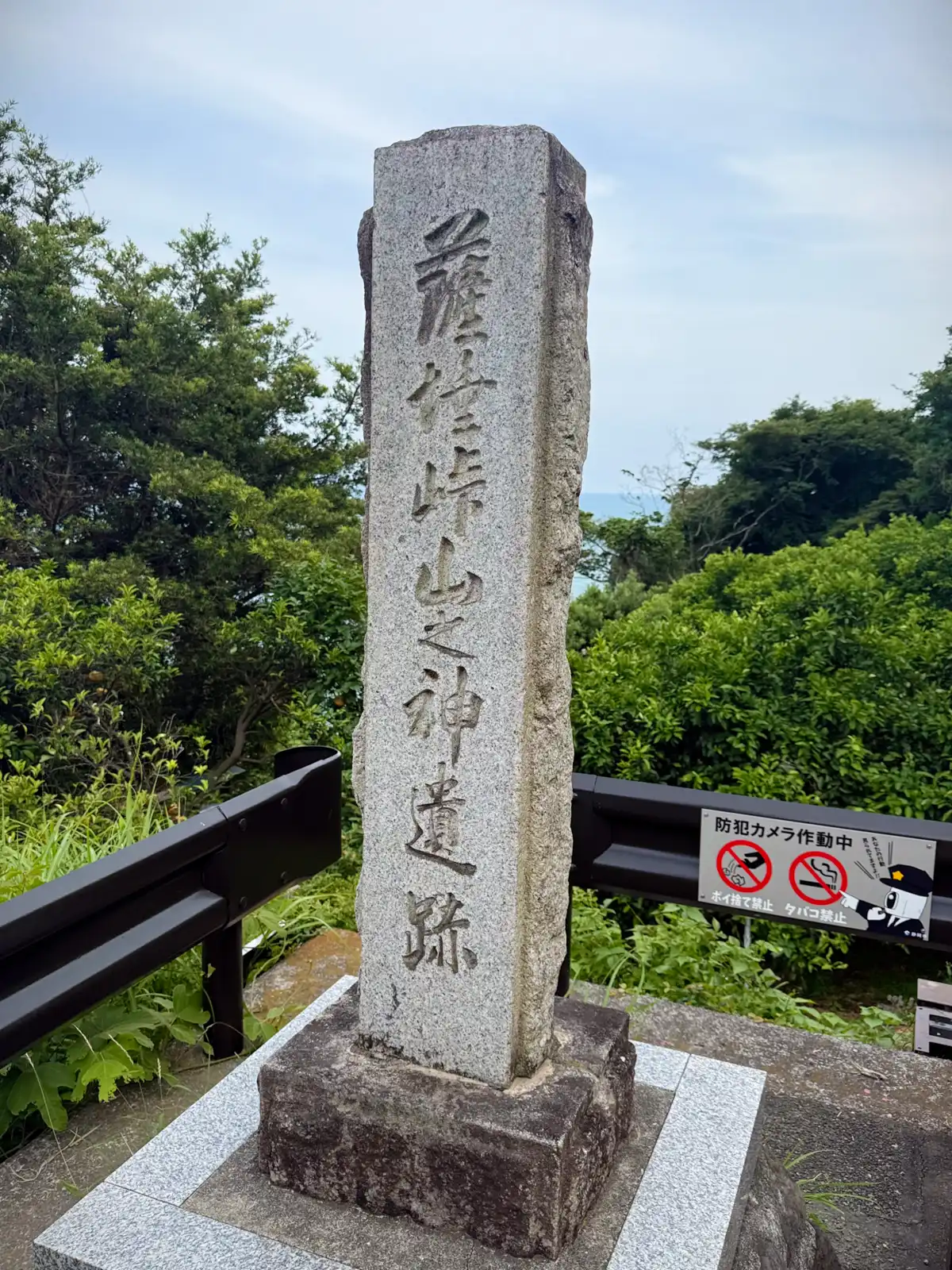
The last stretch gets steep again. Then the road turns a corner and the bay opens up. That low blue line on the horizon is the Izu peninsula. At the top there is a small parking area with room for a few cars, a toilet, and a stone marker.
This is not the summit, though. It is the notch the road goes over. Satta-yama’s top is 244 meters above the sea, about 400 meters back, and the ridge keeps going from there to Hamaishi-dake at 707. There is a view from up there too, and you can see all the way around. But to get all three at once, the road, the sea, and Fuji, you have to be right above the cliff. That is here – 93 meters.
The marker names the spot the Yamanokami site, after a mountain god that was once enshrined here. The shrine itself is gone from here. It stands at Nishi-Kurasawa now, the village at the foot of the climb.
The mountain used to be called Iwaki-yama. By the old account, in 1185 a fisherman’s net off Kurasawa beach came up with a stone Jizō in it. The statue was carried up and enshrined on the cliff, and as Jizō worship spread the old name gave way and the mountain became Satta-yama. Jizō is a bodhisattva, from the Sanskrit bodhisattva, and satta is the second half of that: sattva, a living being. The statue itself is at Tōshōin in Okitsu now, shown once every three years.
So the mountain’s name means every living thing. It is also pronounced the same as the past tense of leaving: 薩埵 in the name of the pass, 去った in ordinary speech, both of them satta, meaning gone. In 1861, when Princess Kazunomiya’s bridal procession traveled to Edo to marry the shogun Iemochi, it went by the Nakasendo route instead of the Tokaido. The reasons were security and water. The shogunate’s own petition to switch routes cited roaming Mito ronin and the Tokaido’s rivers running too full to cross. But the story people tell is that you do not send a bride past a place whose name says she’s gone.
From the marker the view is out across the bay to the hills of Izu. The road was not built for the view, though. It was built because the shore below was killing people.
There was an older road here first.
The shoreline route, the one you ran, was the shitamichi, the lower road. In 1655 a Korean embassy was coming through on its way to Edo, and the shogunate could not be seen walking foreign envoys along a road that drowned people. So a road was cut across the middle of the mountain for them. That is the nakamichi, the middle road, the one that made “Satta Pass” a name people used.
Then in 1680 a heavy sea wrecked both the shore road and the new pass road, and while the middle road was being repaired a third was cut higher up the mountain as a detour. That one opened in 1682, and it is the one that is still there: the uemichi, the upper road, where I pushed the bike up. It became the main Tokaido. Nobody was getting swept off it, but it was still kilometers of steep mountain track, and Satta was counted with Hakone and Suzuka as one of the three hardest crossings on the Tokaido. Yui, the post town just east of here, was small, only about 160 households. Its job was mostly to be the place you got ready at.
One more thing about that name. The usual explanation of oyashirazu koshirazu is every man for himself. Yui also keeps a darker telling. The versions differ, but it goes something like this. A young man sent to Edo to work, in some versions named Chūichi, comes home to see his father, who lives on the far side of the pass. He stops at his aunt’s house in Yui, and she mends a tear in his kimono. It gets late. She tells him to stay the night, but he goes on anyway. The next day, uneasy, she crosses over to her brother’s house to ask after him, and is told the boy never arrived. She mentions the kimono, and her brother’s face changes. Then she looks into the garden and sees the kimono she mended the day before, hanging out to dry. Her brother had turned highwayman on the pass, and had robbed and killed his own son in the dark without knowing him. In one telling he is found dead in the hills the next morning. In another he goes back to the pass and throws himself off it, after his son.
It is probably not history. Even the people who tell it say they do not know. It looks like a story made up to explain the name, rather than a name that came out of the story. The name says a parent did not know his child. So somebody came up with a parent who really didn’t.
Then, in 1854, the Ansei Tokai earthquake lifted this coast. The waterline pulled back a long way, and the shore that had been killing travelers for centuries turned into ordinary walkable ground. The pass had been built to avoid the sea, but then the sea moved out of the way. The Tokaido went straight back down to the shore. The railway followed in 1889, and the expressway in 1969. The pass was left holding a view.
But the hill is still moving, and it has taken houses with it before.
Between 1858 and 1974, the Yui district recorded 26 landslide disasters. That is one every four or five years. In September 1948 a typhoon brought roughly 75,000 cubic meters of the hillside down and closed the railway. On the night of Tanabata in July 1974, a typhoon dumped 376 mm of rain on Yui station and 546 mm further up the valley. Seven houses were destroyed and thirty-two damaged. The railway was closed for a week, and Route 1 for twenty-three days.
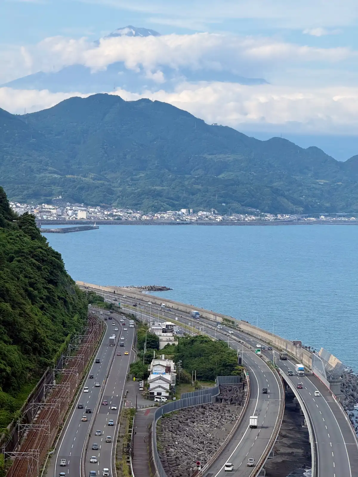
That is a problem, because nothing down there has a detour. Somewhere around ninety freight trains a day run through this gap, one of the heaviest freight lines in the country, and Route 1 and the Tomei are both designated critical logistics routes under the Road Act. If a Nankai Trough earthquake closed the roads here, one estimate says it would cost around 15 billion yen a month.
So the state has been holding the mountain up. Since 2005 the Fuji Sabo Office has run a direct-control landslide project on this hillside, roughly 36 billion yen over twenty years: 23 collection wells to draw the groundwater out, about 1,480 meters of drainage tunnels, and 61 deep concrete piles sunk into the slope, some of the largest in Japan, to physically stop the hill from moving. It is designed against a hundred-year rain and a shindo 6-upper shake from the Nankai Trough, which is the level at which people cannot stand and hillsides come down. There is even a proposal, from a construction industry group, to move the Tomei inland into an 8 km bypass, six of those kilometers in tunnel, for around 150 billion yen.
Almost all of it is under your feet. You are looking at a postcard, and the postcard is a picture of three arteries with nowhere else to go, taken from on top of the thing that is trying to fall on them.
From the parking area a footpath keeps going around the hillside. This is the old Tokaido road, so it is worth the walk. A hundred and fifty meters along there is an observation deck, and the view from it is better. The expressway sweeps around the headland at the water’s edge. Route 1 and the railway are pinned between it and the cliff. The whole bay opens out behind them. There are also two cameras up there. One holds the whole of Fuji, the other is zoomed in on the road, and both stream 24 hours a day, 365 days a year. You can check whether the mountain is out before driving up.
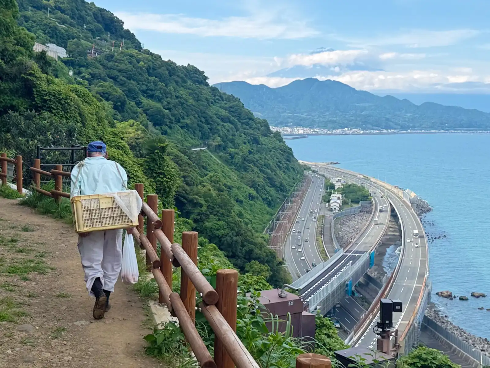
Fuji was mostly gone that day. The summit was up above the cloud, cut off from everything under it, and we all took pictures of the cloud, in case it was hiding something. The reliable months are December to March, when the air is mostly clear. I was here in June. Hiroshige’s print has it whole, of course, white and clean above the bay. He did not have to wait for the weather.
I got back on the bike and rolled down into Yui. It took about five minutes of fairly serious braking. Down at the bottom, the modern road does not climb the mountain at all. It goes around, at sea level, on ground that was under water until an earthquake pushed this whole coast up.
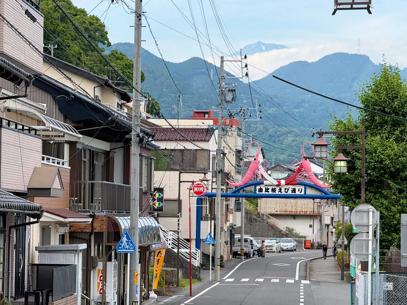
See more photos of Satta Pass in the gallery.