Tokyo to Fukui by E-Bike, Day 4: Down the Salt Road to the Sea of Japan and Toyama
The fourth day of the ride to Fukui was the longest one yet, about 130 kilometers from Hakuba down to Toyama City. It started with the Northern Alps glowing in the morning sun, followed by a long downhill run along the old Salt Road through what felt like an endless chain of tunnels. Around midday the Sea of Japan finally appeared, and I spent the rest of the afternoon following the coast past a jade beach, a seaside shrine, and old towns turning orange at sunset.
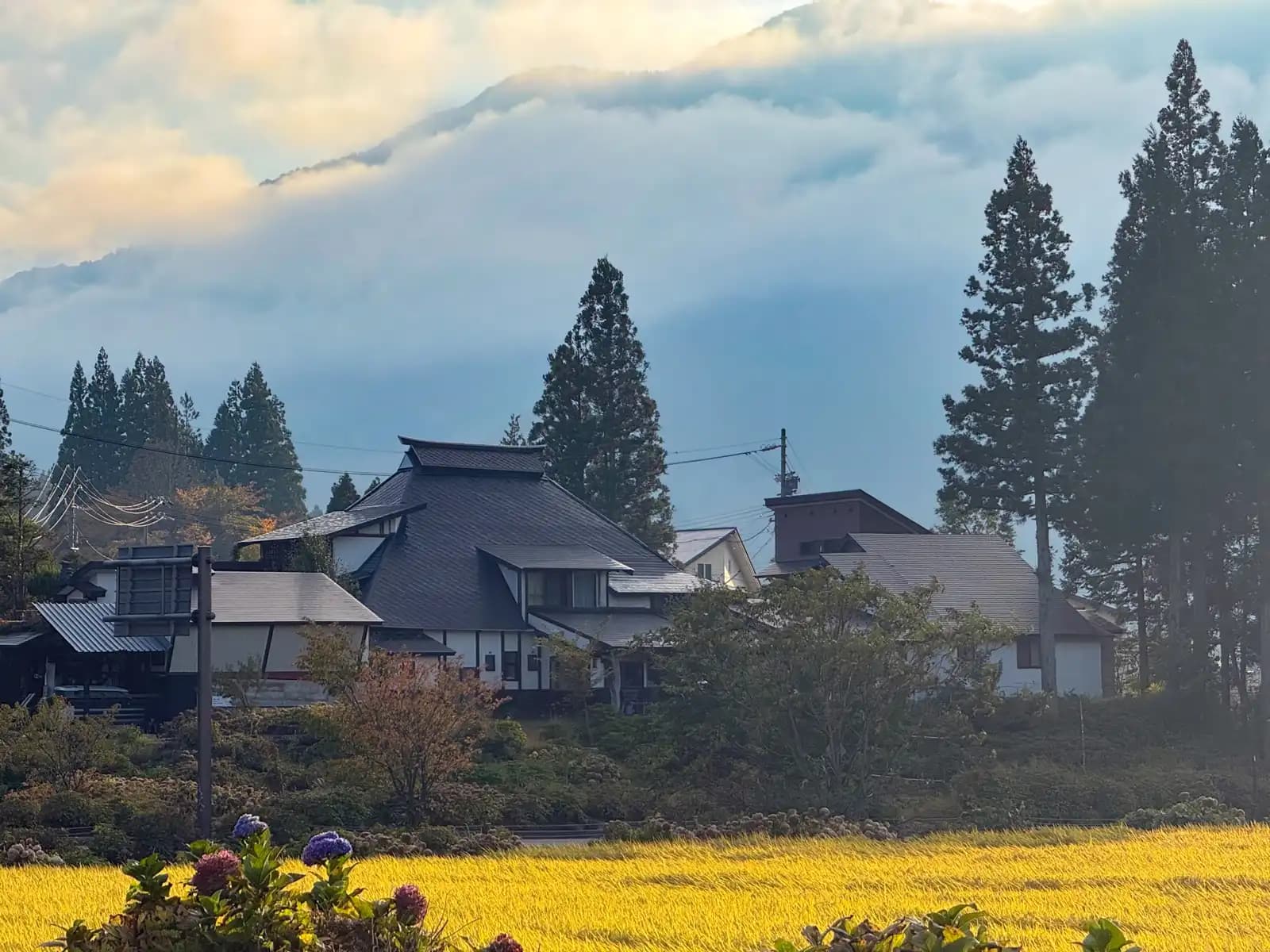
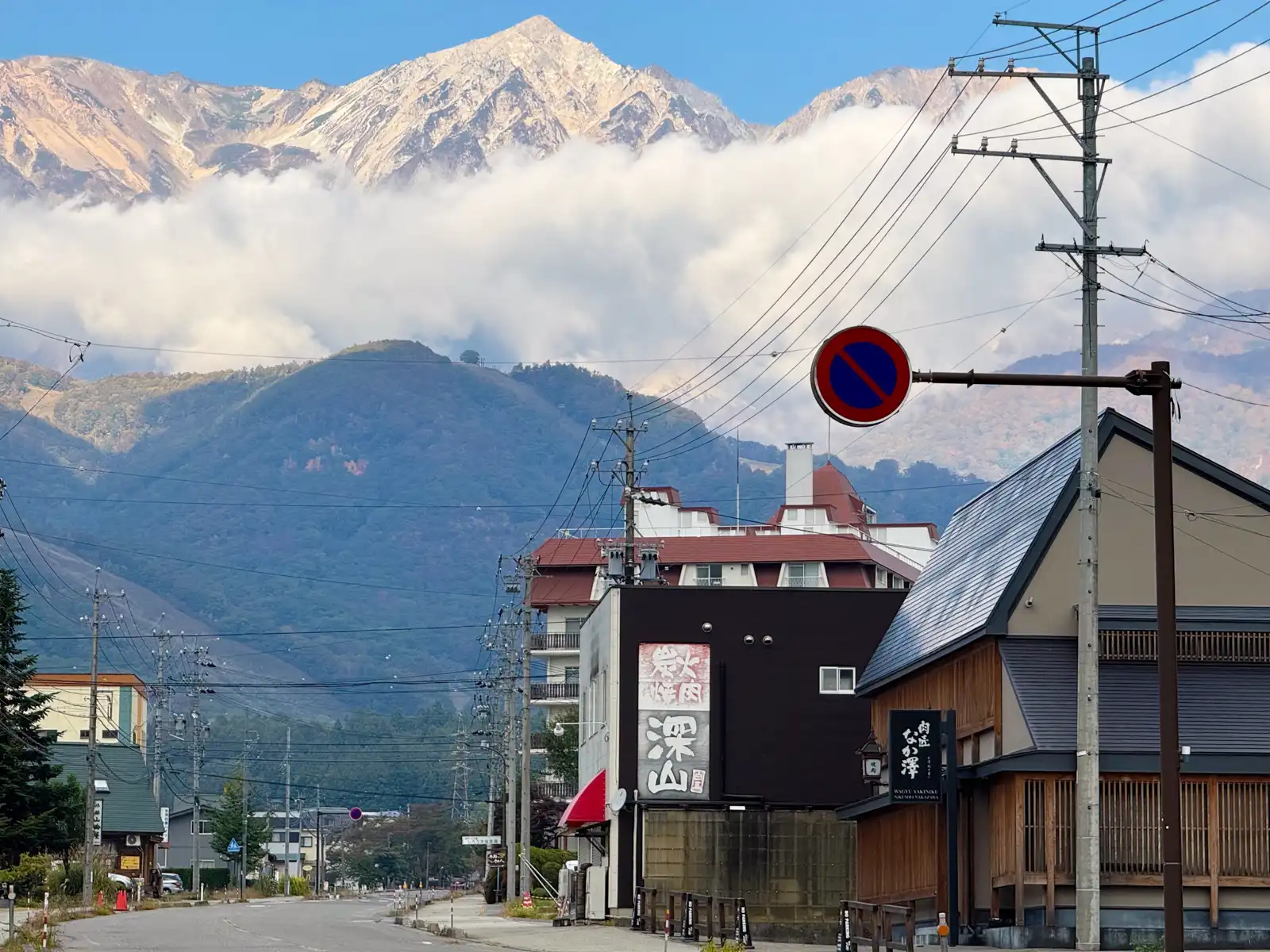
When I got to Hakuba the evening before, the sun was already behind the mountains, so all I could really see of them was a dark, jagged outline against the sky. I knew they were big, of course, but I didn’t really know what they looked like. So the next morning, when I wheeled the Beast out of the guesthouse entrance onto the road and looked up, I kind of forgot what I was doing for a minute. The sun was now on the other side of the valley, shining straight onto the peaks and lighting up all that bare rock in a soft gold, with a long band of white cloud hanging across the middle of them. Exactly what you’d expect from a proper Alpine region.
So, of course, the photo session from the day before started all over again. I’d ride maybe a hundred meters, see the mountains from a slightly different angle between two buildings or behind some trees, and stop again. And then again. It was honestly really hard to stop. At some point I had to convince myself to get going, because I had about 130 kilometers ahead of me, and at this rate I’d get to Toyama sometime next week.
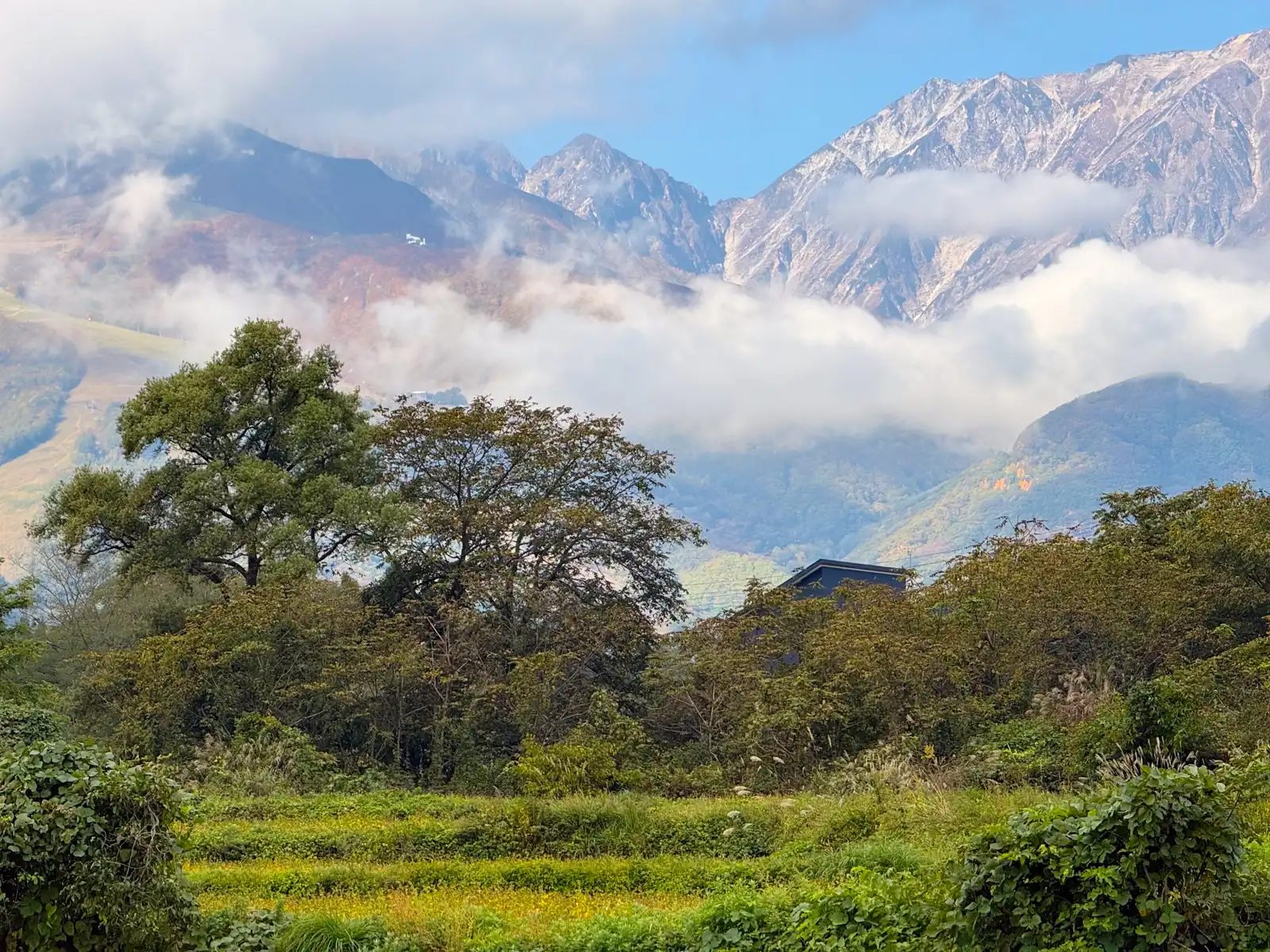
The good news was that a big part of those 130 kilometers would be downhill. Hakuba is at roughly 700 meters above sea level, so the first half of the day was basically about getting from up here down to the coast, and then following the coast west to Toyama. In the end, something like 40 or 50 kilometers of the ride went downhill. Not all of it, and not the whole time, but most of it, and it felt great. After two days of climbing up the Usui Pass and the Olympic Road, it felt like I’d finally earned it.
The road out of Hakuba is National Route 148, which follows the Himekawa River north through a long, narrow valley all the way to Itoigawa on the coast. Long before it became a national road, this was the Chikuni Kaido, better known as the Shio no Michi, or the Salt Road. It ran for about 120 kilometers between Itoigawa and Matsumoto, and as you can probably guess from the name, it was mainly used to bring salt from the Sea of Japan up into the mountains of Shinano, which had no coast of its own. Salt and seafood were carried inland by cattle and by porters called bokka, and things like soybeans, tobacco, and hemp went back down the other way. The trade was pretty one-sided, too. A year’s worth of records from the late 1850s shows roughly ten times as much going into the mountains as coming out of them.
The road is also connected to a well-known Japanese saying. The story goes that when the lands of the warlord Takeda Shingen were cut off from their salt supply, his big rival Uesugi Kenshin of Echigo kept sending salt to them anyway, and that’s supposedly where the expression teki ni shio o okuru, “sending salt to your enemy,” comes from. It’s hard to say whether it really happened like that, but it’s a nice story. I was of course going the opposite direction from all that salt, and I wasn’t carrying anything more valuable than… a phone full of mountain photos.
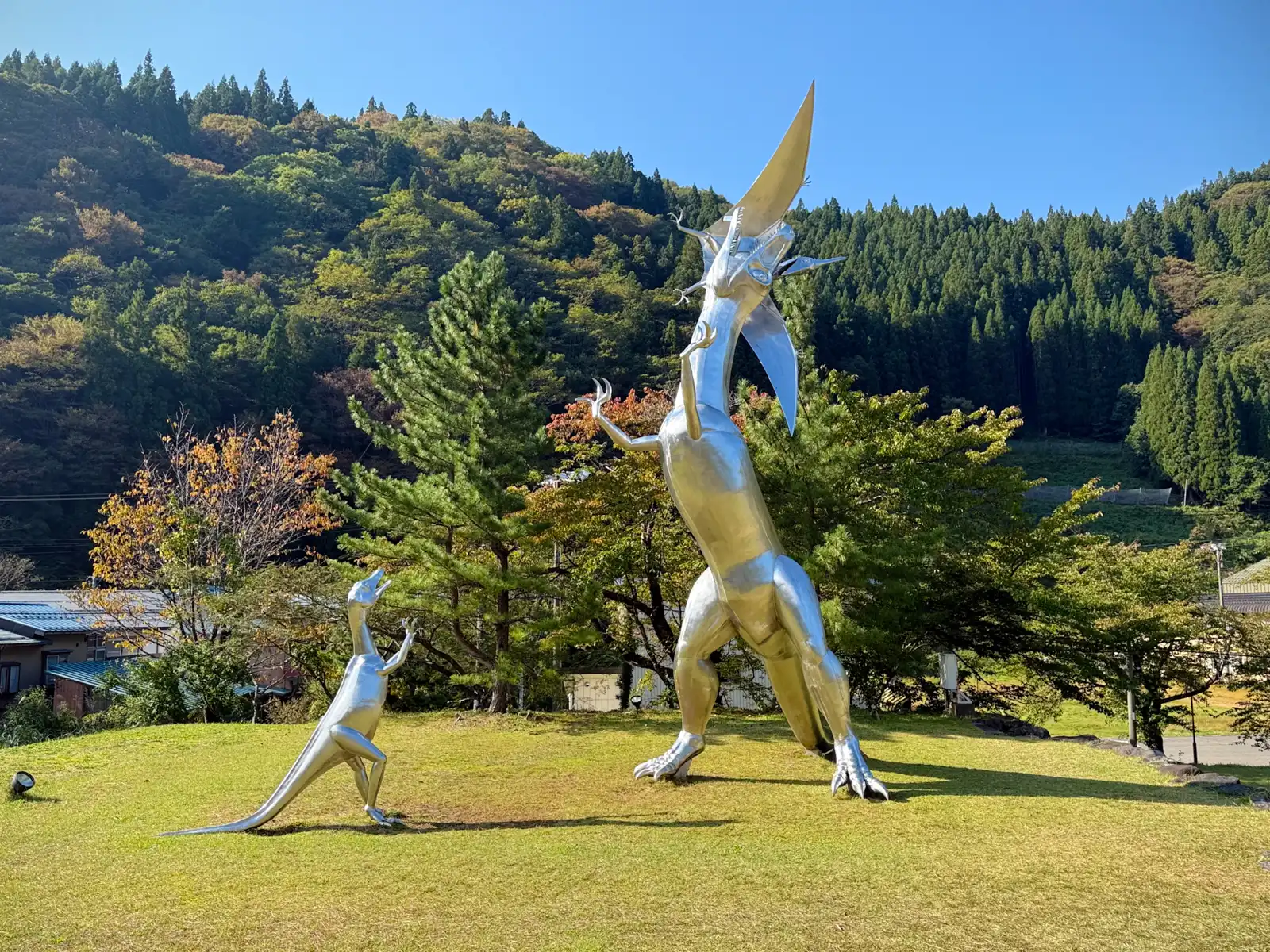
The last village on the Nagano side is Otari, and at Michi-no-Eki Otari, the village’s roadside station, I passed something quite unexpected. On a small grassy hill stood two big silver dinosaurs, a tall one and a smaller one, both looking up at the sky. If you look a bit closer, though, there’s a third one, a pterosaur with its wings spread wide, right at the tall one’s mouth. Looking at my photos later, it seems the big one caught it in mid-air and has it in its jaws, which would explain the wings. Not a great day to be a pterosaur. Meanwhile, the little one was just standing there looking up at the big one, as if it were asking for pocket money. The monument was made by Daido Nakajima, a sculptor who works with stainless steel, and it was put up in 1999. According to his website, the big one is about 11.5 meters tall, and the piece was made to mark the village’s recovery from a disaster, most likely the huge flood that hit the Himekawa valley in July 1995, and also as a symbol of the village’s energy. The dinosaurs weren’t a random choice, either. In 1994, six small footprints left by a meat-eating dinosaur were found in the rocks here, and they’re believed to be the oldest dinosaur footprints in Japan, from the Early Jurassic. These three shiny guys didn’t look very Jurassic, but I appreciated the effort. The timing was kind of funny, too. The whole point of this trip was to get to Fukui, a prefecture known all over Japan for its dinosaurs, and here I was, still days away, already getting a little dinosaur welcome. It was almost like Fukui had sent them out ahead to make sure I was still coming.
If I had to give Day Four a nickname, it would be the day of tunnels. The mountains along the Himekawa are so close together that the road often has no choice but to go straight through them, and for about half the day it felt like I spent more time inside mountains than outside. Some of the tunnels were pretty long, too. Others were only half tunnels, with the mountain on one side and a long row of concrete pillars on the other, kind of like an arcade. Through the gaps between the pillars I could see the valley outside, the river far below, and steep green slopes on the other side. These are snow sheds, built to keep avalanches and falling rocks off the road, and there are a lot of them. On one stretch of about 15 kilometers in Itoigawa alone, there are close to 6 kilometers of snow sheds and another 4 kilometers of tunnels. This valley gets a lot of snow every winter, and keeping the road open used to be a real struggle. In 1981, heavy snow closed it for more than 70 days.
In quite a few of the tunnels, workers were doing maintenance, so one of the two lanes was closed. When that happens in Japan, there’s a guy with a flag at each end, letting one direction through at a time. At one of them, an older guard stopped me, and since there was nobody else around at that moment, we chatted a bit about where I was coming from. Then cars started lining up behind me, so I let them all go in first, and only after the last one had gone inside did he wave me through. That’s how I ended up with a whole tunnel to myself. Just me, the Beast, a long row of lights on the ceiling, and all the “fresh air” the cars in front of me had so kindly left behind. I’m pretty sure each of those private tunnels took a few days off my life, which was at least a good reason not to hang around in there. Depending on how much it sloped downhill, I could go pretty fast, too.
The funny part was at the other end. Since only one lane was open, the cars going the other way had to wait until everyone in my direction had passed, and I was the very last one. So when I came out into the daylight, there was a line of cars and trucks, easily a hundred meters long, waiting at the entrance. I can only imagine what the drivers were thinking. They’d been staring into that dark hole for a while, wondering what was taking so long, and then out comes one guy on a bicycle with a bag on the back. Like the final boss finally coming out of the cave, just a lot less scary. This happened three times that morning, and it was funny every single time.
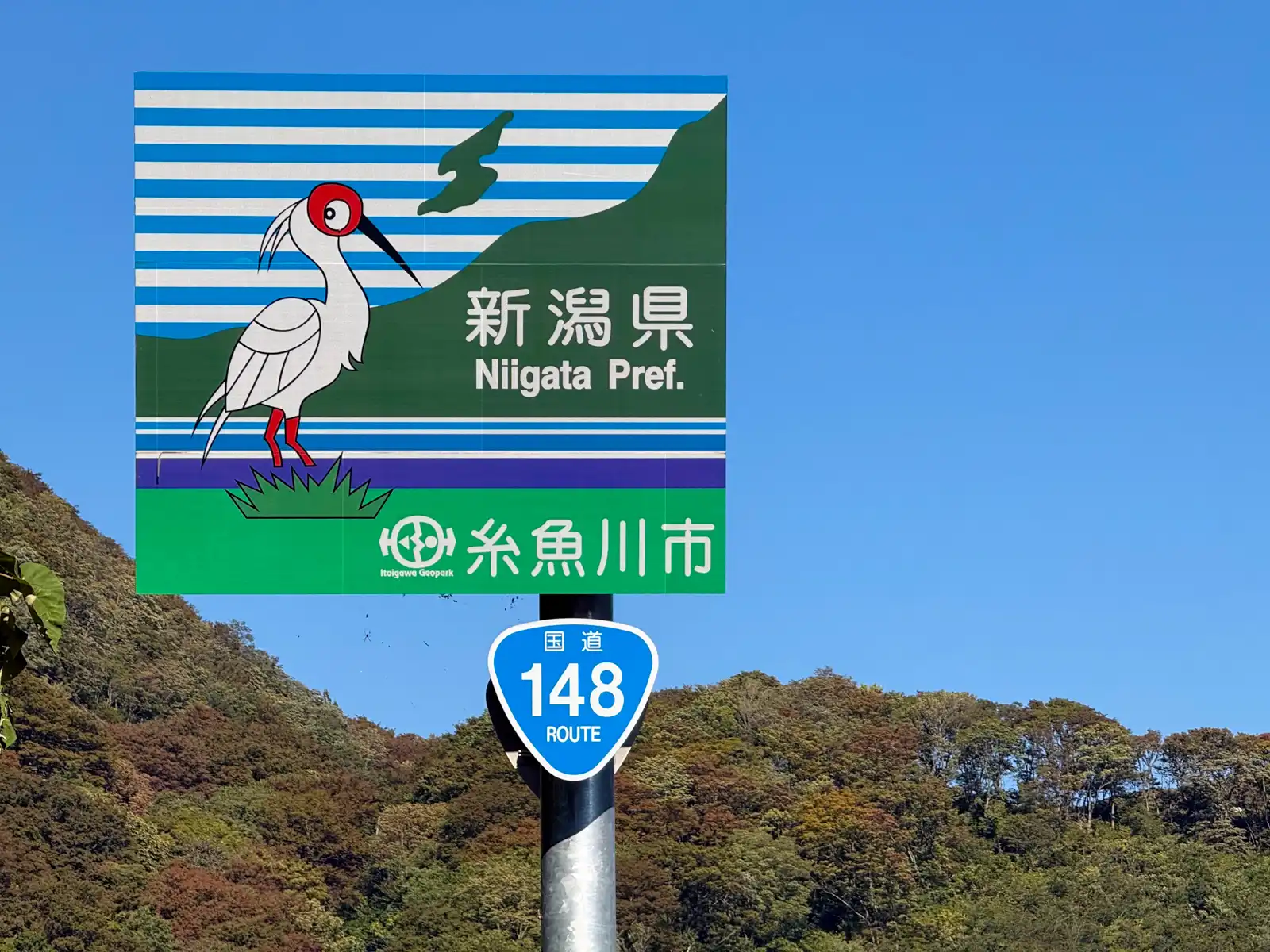
Somewhere in all those tunnels I left Nagano without even noticing. The first I knew of it was a big roadside sign welcoming me to Niigata Prefecture and the city of Itoigawa. On it is a crested ibis, the toki, which is Niigata’s prefectural bird, with the outline of Sado Island behind it. The toki has had a pretty rough history. By 1981 there were so few left in the wild in Japan that the last ones on Sado were all caught so they could be bred in captivity, and it wasn’t until 2008 that some could be released back into the wild there. Since 2012 they’ve been breeding in the wild on Sado again, so the bird on that sign is actually a bit of a comeback story.
From the border, Route 148 keeps winding down the valley, following the river around every bend. The road was quiet, the morning was warm, and since it was mostly downhill, the Beast’s motor barely had anything to do. For long stretches it was basically just along for the ride, same as me.
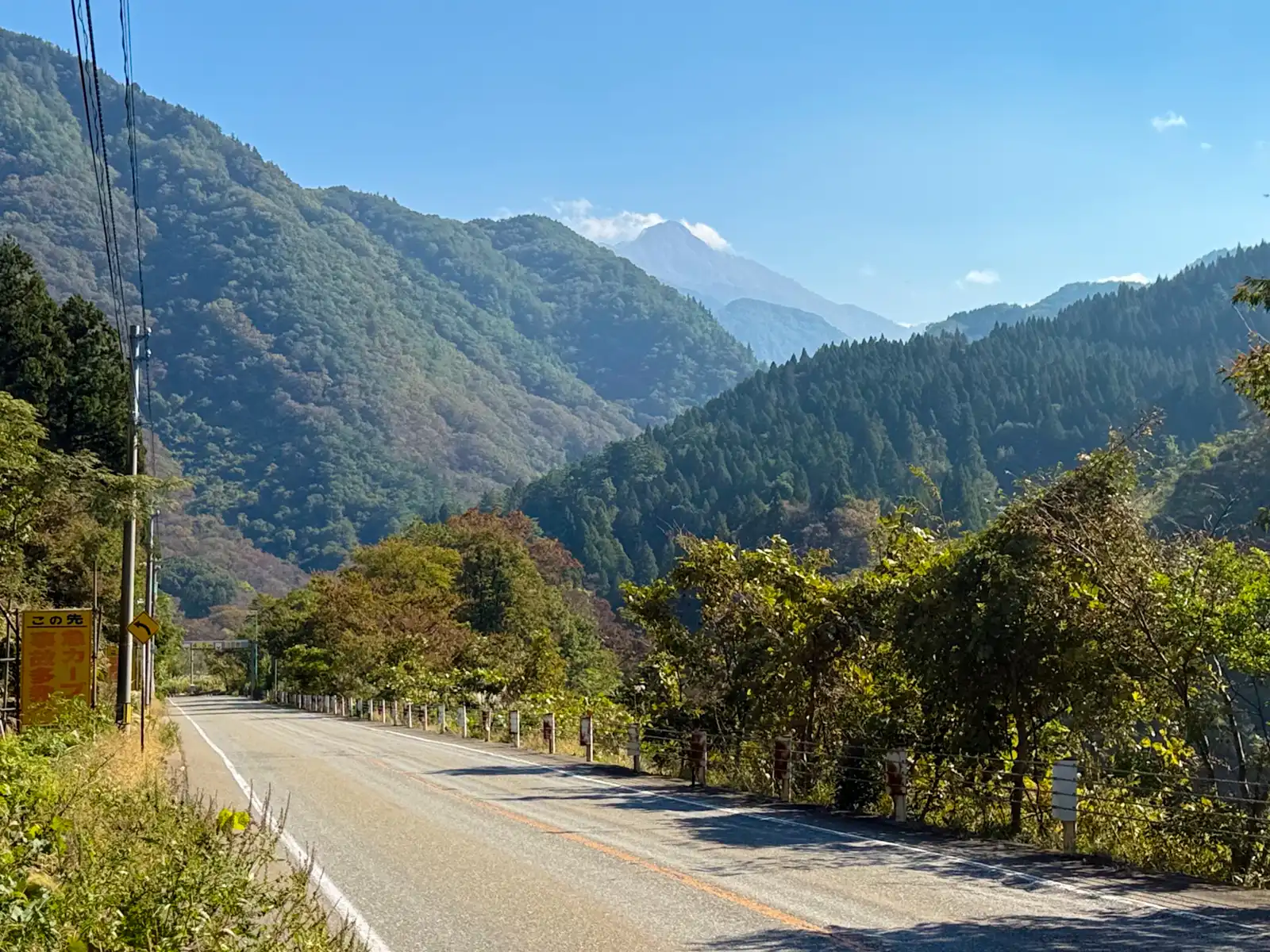
This whole area is part of the Itoigawa UNESCO Global Geopark, which in 2009 became the first place in Japan to be named a Global Geopark. Geologically, it’s kind of a big deal. Itoigawa sits at the western edge of the Fossa Magna, a huge rift that opened up when the Japanese islands were pulling away from the Asian continent, and the Itoigawa-Shizuoka Tectonic Line, the fault that’s often said to split Japan into east and west, runs right through the city. A bit further down the valley, I could see one of the geopark’s highlights from the road. Mt. Myojo has a huge pale wall of rock rising straight up above the trees. It’s made of limestone, from a coral reef that formed somewhere far away around 300 million years ago and then slowly drifted all the way here. Its south face, a sheer wall of about 450 meters, is a popular spot for rock climbers. I was perfectly happy just looking at it.
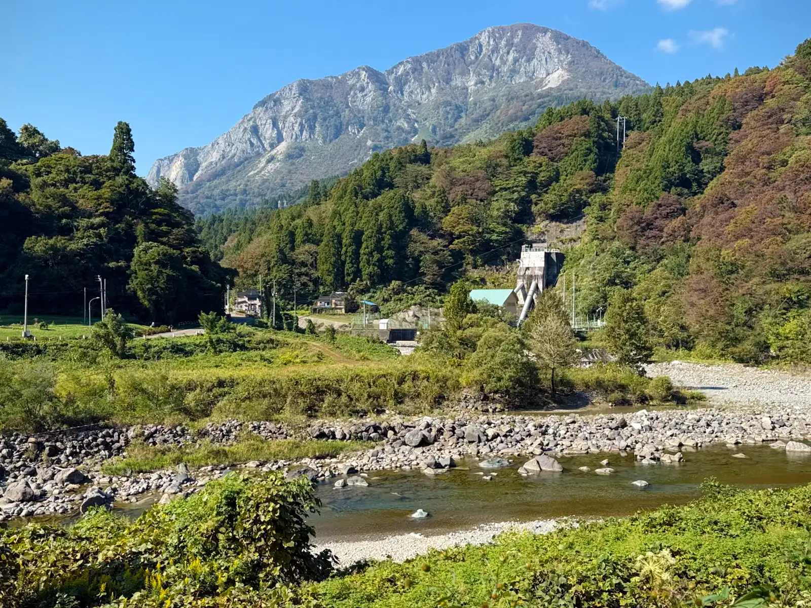
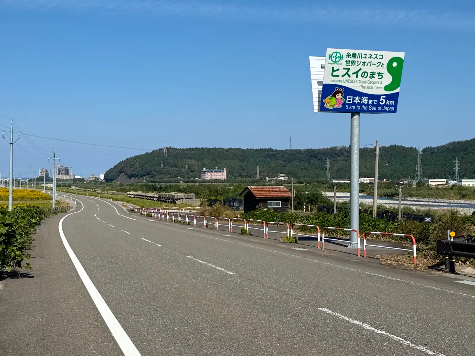
At the foot of that wall runs the Kotaki River, a small branch of the Himekawa, and this is where Itoigawa’s other claim to fame comes from. The Kotaki is the home of Itoigawa jade, or hisui. People here were already working jade more than 5,000 years ago, back in the Jomon period, and Itoigawa jade traveled surprisingly far, all the way from Hokkaido down to Okinawa and even across the sea to the Korean Peninsula. Then, somehow, it was all forgotten for more than a thousand years. It wasn’t until 1938 that a local man, Ito Eizo, found jade in the Kotaki River again, and it was confirmed as jade the following year. In 2016, Itoigawa jade was even chosen as Japan’s national stone. So it’s no wonder the signs along the road keep reminding you that this is the Jade Town.
By now the mountains were getting lower, and the valley opened up into flatter land with houses, fields, and a riverbed that kept getting wider and stonier. A sign along the river said there were only 5 kilometers left to the Sea of Japan. After three and a half days in the mountains, that sounded like a very small number.
At around 11 in the morning, somewhere near Omi on the western side of Itoigawa, it happened. Out of nowhere, the sea was right there on my right side, this huge, deep blue sheet of water going all the way out to the horizon. My first thought was pretty much “oh, finally!” I quickly crossed the street, parked the Beast, took some pictures, and then just stood there looking at it for a while. It was my first time ever on the Sea of Japan side of the country, so it felt like kind of a big moment.
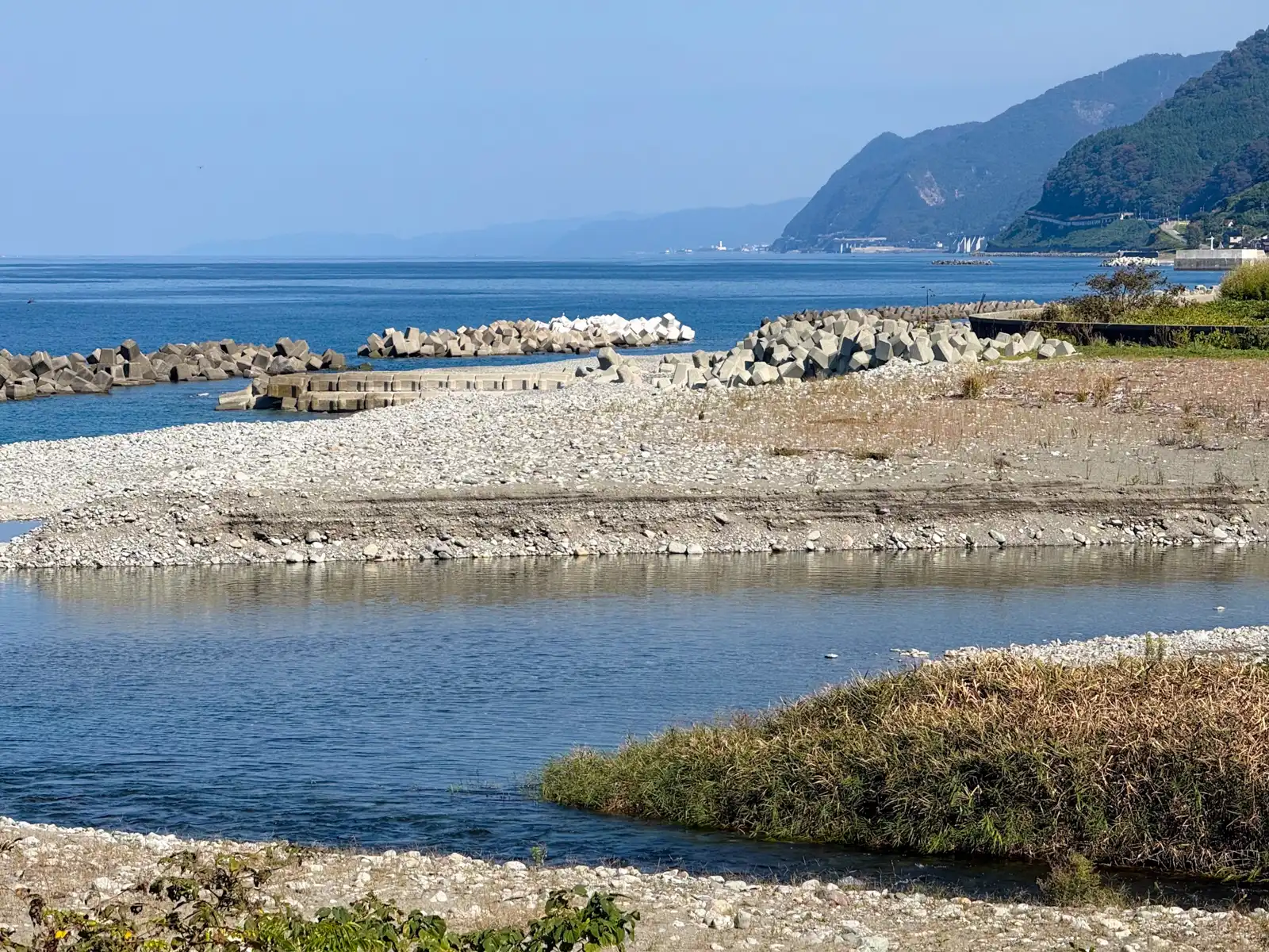
It was the middle of October, but it felt a lot more like summer. It was hot, there were hardly any clouds, and with the sky that clear, the sea was the kind of blue you normally only see on postcards. All along the shore, big piles of concrete blocks were stacked in the water. Most people just call them all tetrapods, although strictly speaking that’s the name of one particular four-legged design. My first guess was that they were there because of tsunamis, but their real job is more ordinary than that. They break up the force of the waves so the sea doesn’t slowly eat away at the coast, and since Japan has a lot of coast to protect, you see them pretty much everywhere. The roads along the sea here in Niigata are also really wide, with hardly any traffic. Honestly, on some stretches it felt like the road had been built just for me.
West of Omi, the mountains come right down to the sea again, and the road has to squeeze along the bottom of them. This stretch of coast is called Oyashirazu, and it has quite a reputation. For centuries, the main road along the Sea of Japan simply ran along the beach at the foot of the cliffs, and travelers had to wait for a calm moment and then run for it between the waves. The name translates to something like “the parent doesn’t know,” and it’s said to come from the idea that it was so dangerous that even parents and children had no time to look out for each other. A proper road wasn’t cut into the cliffs until 1883, and these days Route 8 gets through with a lot of help from, you guessed it, more tunnels. I wasn’t going to complain, though. It definitely beat running along the beach between the waves while pushing an e-bike.
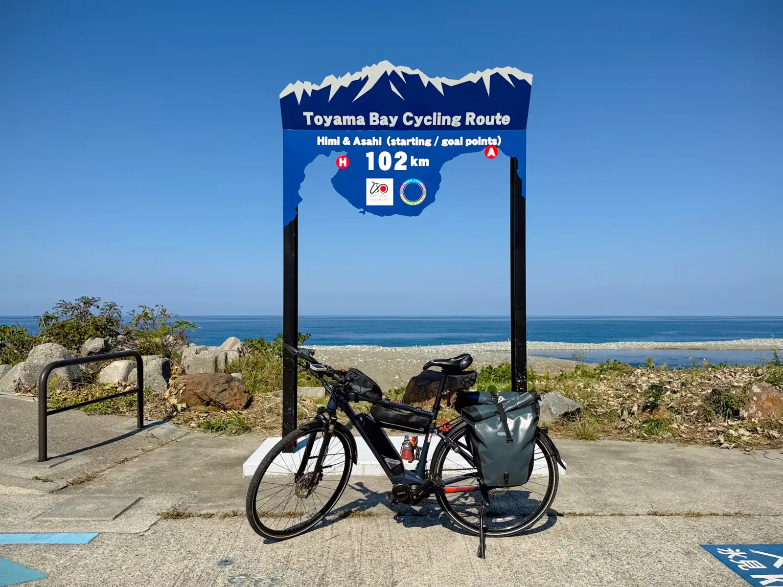
Just past Oyashirazu, the small Sakai River marks the border between Niigata and Toyama, and right at its mouth, on the Toyama side in the town of Asahi, is the end of the Toyama Bay Cycling Route. It runs 102 kilometers around the bay from here to Himi. In 2021 it was named one of Japan’s National Cycle Routes, a title the government has only given to a small number of routes in the country. Since Asahi is one end of it, the marker painted on the ground there actually says GOAL. I was coming from the other direction, though, so I decided it was my start. I didn’t ride the whole thing, but I followed it for most of the way to Toyama City, and it was easy to follow, with a blue line painted along the side of the road.
Looking back east from the river mouth, I could see the coast I’d just come along, with the mountains dropping steeply into the sea and long rows of wave-breaking blocks lying in the water in front of the beach.
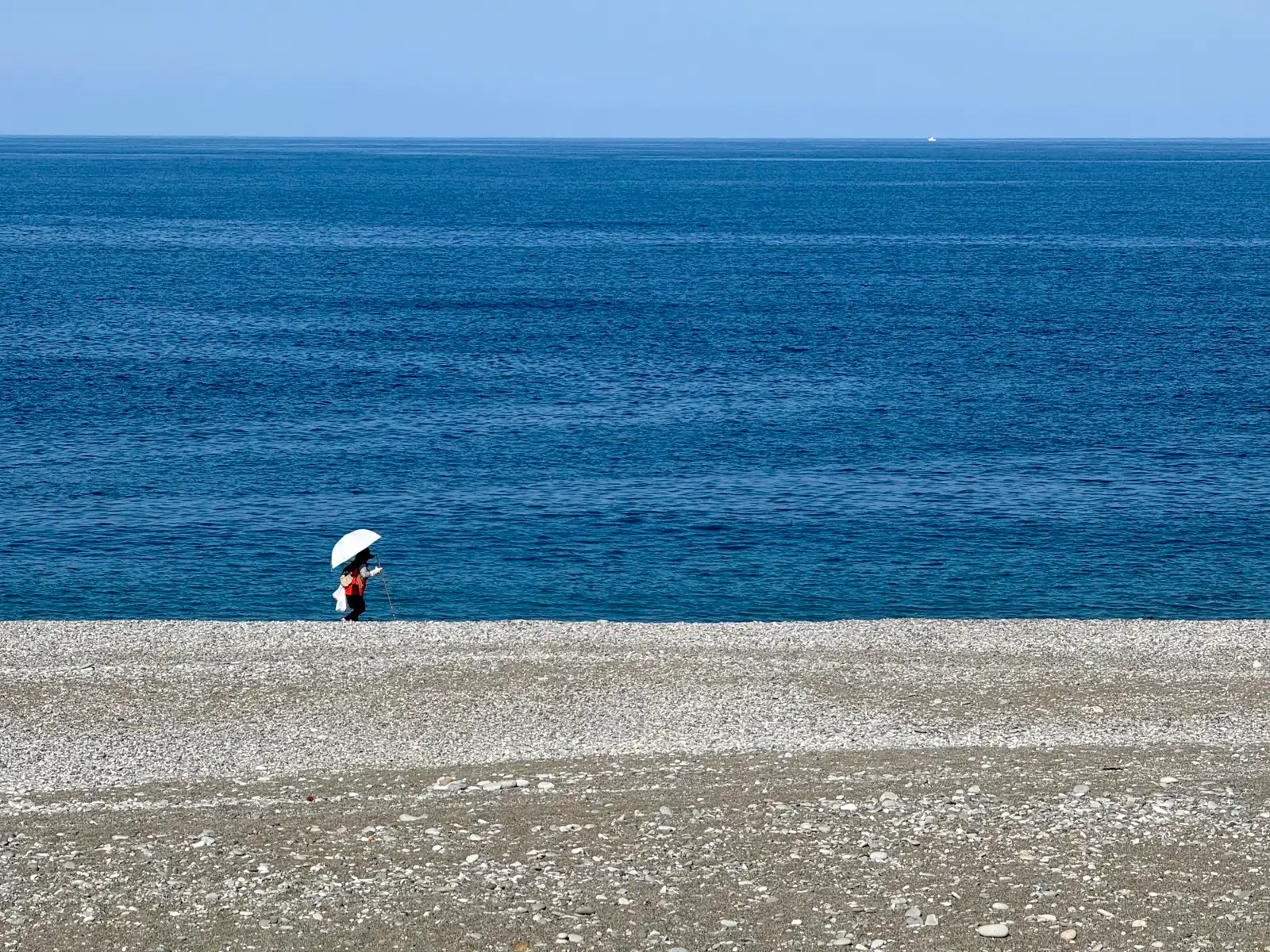
The beach west of the river is officially the Miyazaki-Sakai Coast, but pretty much everyone calls it Hisui Kaigan, the Jade Coast, a nickname it shares with a few beaches back in Itoigawa. It’s a pebble beach about 4 kilometers long rather than a sandy one. The reason for the nickname is that bits of jade from the Itoigawa area get carried down by the rivers and pushed along the shore by the sea, so every now and then some of them wash up here. Apparently the best time to look is the day after rough seas, when fresh stones get thrown up onto the beach. While I was there, someone with a white parasol and a walking stick was slowly walking along the water’s edge, with nothing but blue sea behind them.
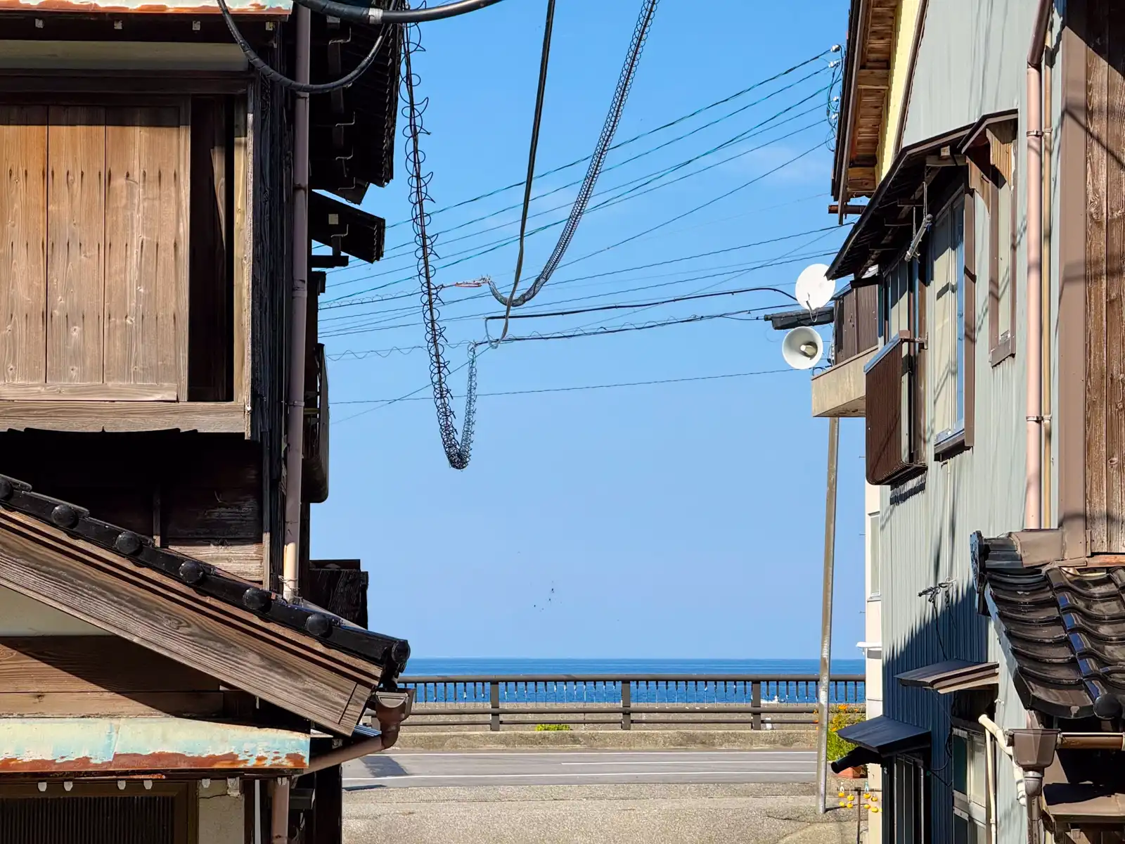
Right behind the beach is Miyazaki, a small seaside neighborhood of old wooden houses, and every now and then a narrow side street would end with a strip of deep blue sea at the far end.
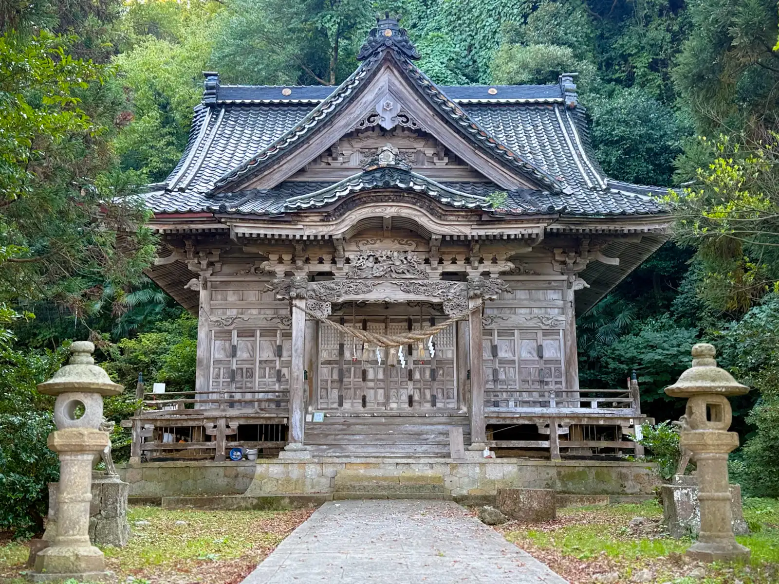
Just off the old Hokuriku road through the neighborhood stands Kashima Shrine. What caught my eye was the wood. The whole main hall is bare, unpainted wood, with no red or any other color, and over the years it has weathered to a soft grey that makes it look really old. Add the heavy dark tiles, the detailed carvings under the roof, a pair of stone lanterns out front, and a thick, dark forest rising right up behind it, and I just had to stop. Unpainted shrines aren’t actually that rare in Japan. Leaving the wood bare is the older Shinto way of building, and the bright red paint so many shrines are known for came later, under the influence of Buddhist and Chinese architecture. Still, this one had aged so nicely that it really stood out. The forest behind it has been a national natural monument since 1936, as a good example of the warm-climate coastal forest of the Hokuriku region, with evergreen trees like tabu and shii. The shrine’s main deity is Takemikazuchi, a god of thunder and swords, who according to local legend came across the sea from the Noto Peninsula. The shrine itself is said to have first stood on a small island just off the coast, until the sea started eating away at it and it had to be moved inland. So the same problem those tetrapods are fighting today, the sea slowly eating away at the coast, apparently pushed even a god out of his home a long time ago.
By now I was getting hungry, and here I ran into a small problem. Along the stretch of coast I was riding there were fields, houses, then more fields, but not a single convenience store. Coming from Tokyo, where you can’t walk two minutes without passing one, that felt almost suspicious. In the end I had to make a little detour inland to find a FamilyMart, where I picked up a pizza-man, a steamed bun with a pizza-style filling, plus some onigiri, and then rode back to the coast to eat.
Standing there with my lunch, I looked back across the fields and saw the mountains rising high behind them. These were the same mountains I’d been staring at in Hakuba that morning, just from the other side. I had basically ridden halfway around them in one big half circle, down the valley on one side and along the coast on the other, and now here they were again. I stood there chewing on my onigiri thinking, man, that’s where I came from. It’s a strange feeling, being able to see your whole day in front of you like that, but a pretty satisfying one, too.
From there I still had about 70 kilometers to go, all of it flat. After a morning of tunnels and downhill fun, this was a very different kind of riding, long and steady, with the sea on one side and rice fields and mountains on the other. There are no big cities along this part of the coast, just one small town after another, each one blending into the next almost without you noticing. In Uozu, a big red Ferris wheel suddenly popped up over the houses. It belongs to Mirage Land, an amusement park named, I’m guessing, after the mirages Uozu is known for, which sometimes appear over Toyama Bay in spring. Unfortunately, I didn’t see any mirages. Just a Ferris wheel, which at least was real.
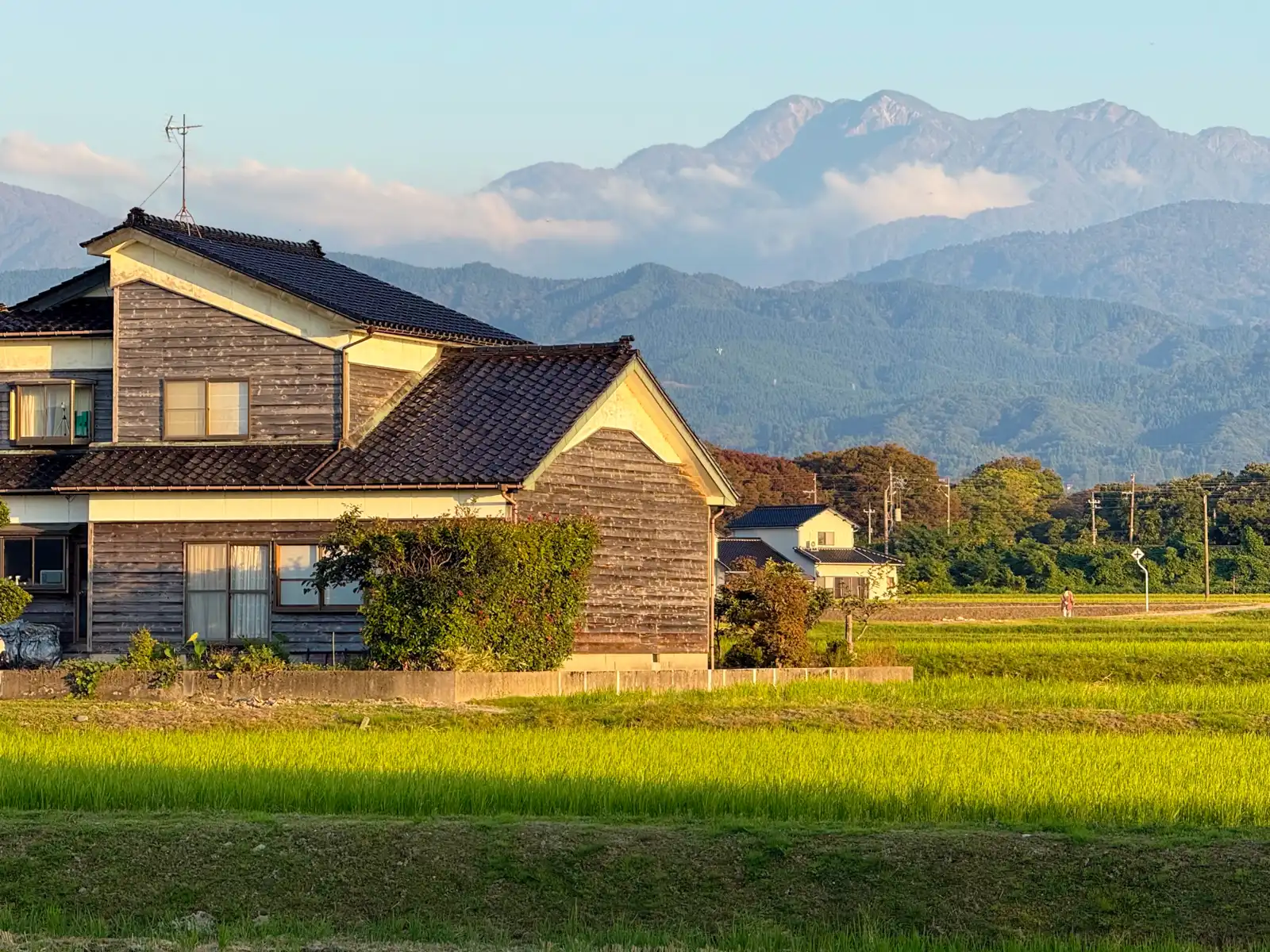
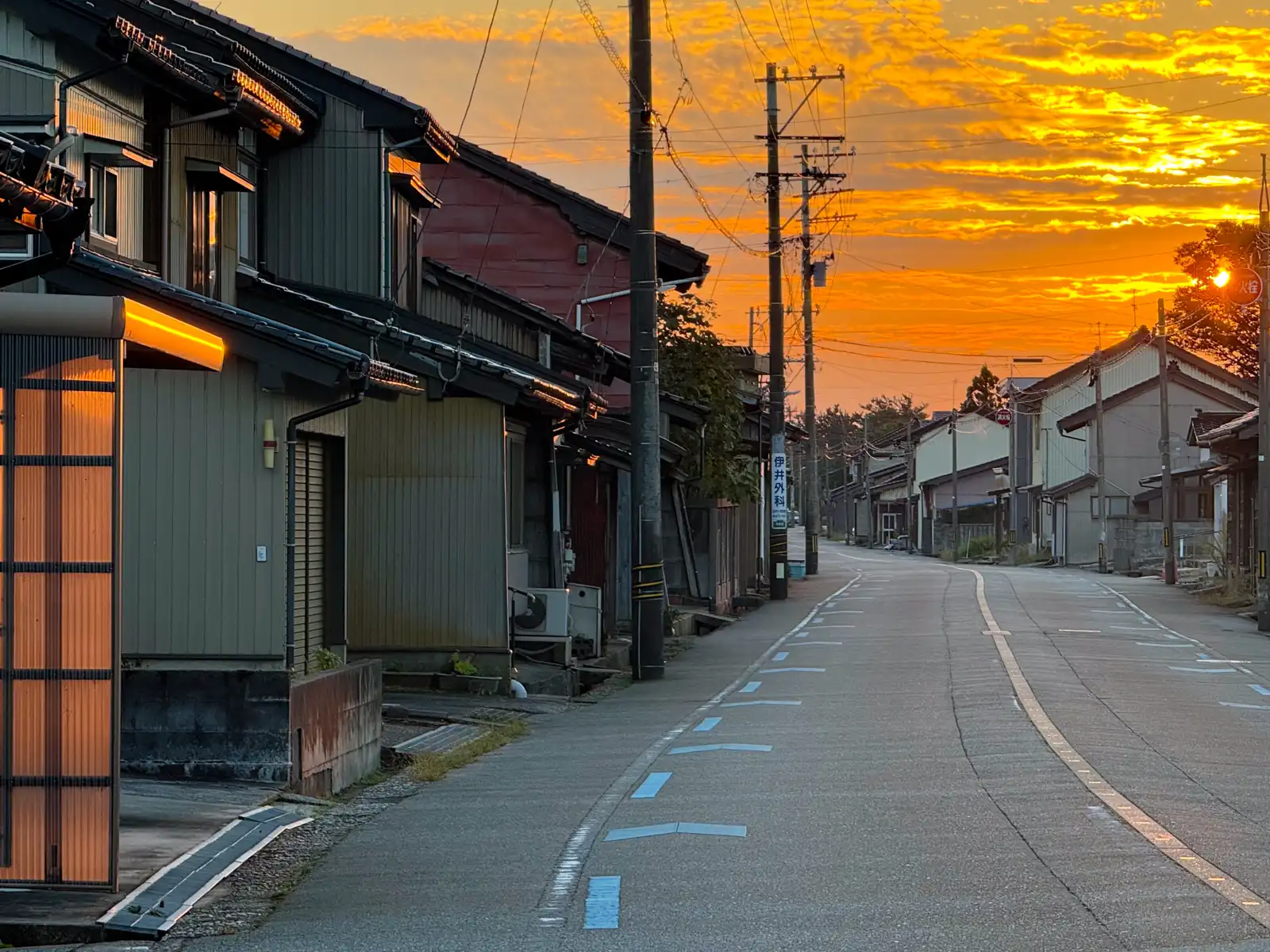
The best part of the afternoon came near the end, when the sun was getting low. Some of the towns along the way, like Namerikawa, still have lots of old houses with dark wooden walls and shiny black tiled roofs, and as the sun went down, it lit them all up in warm orange. Even the mountains far behind them picked up a soft pinkish glow. Pretty much every street I turned into looked like a postcard, which, considering the name of this blog, I took as a good sign.
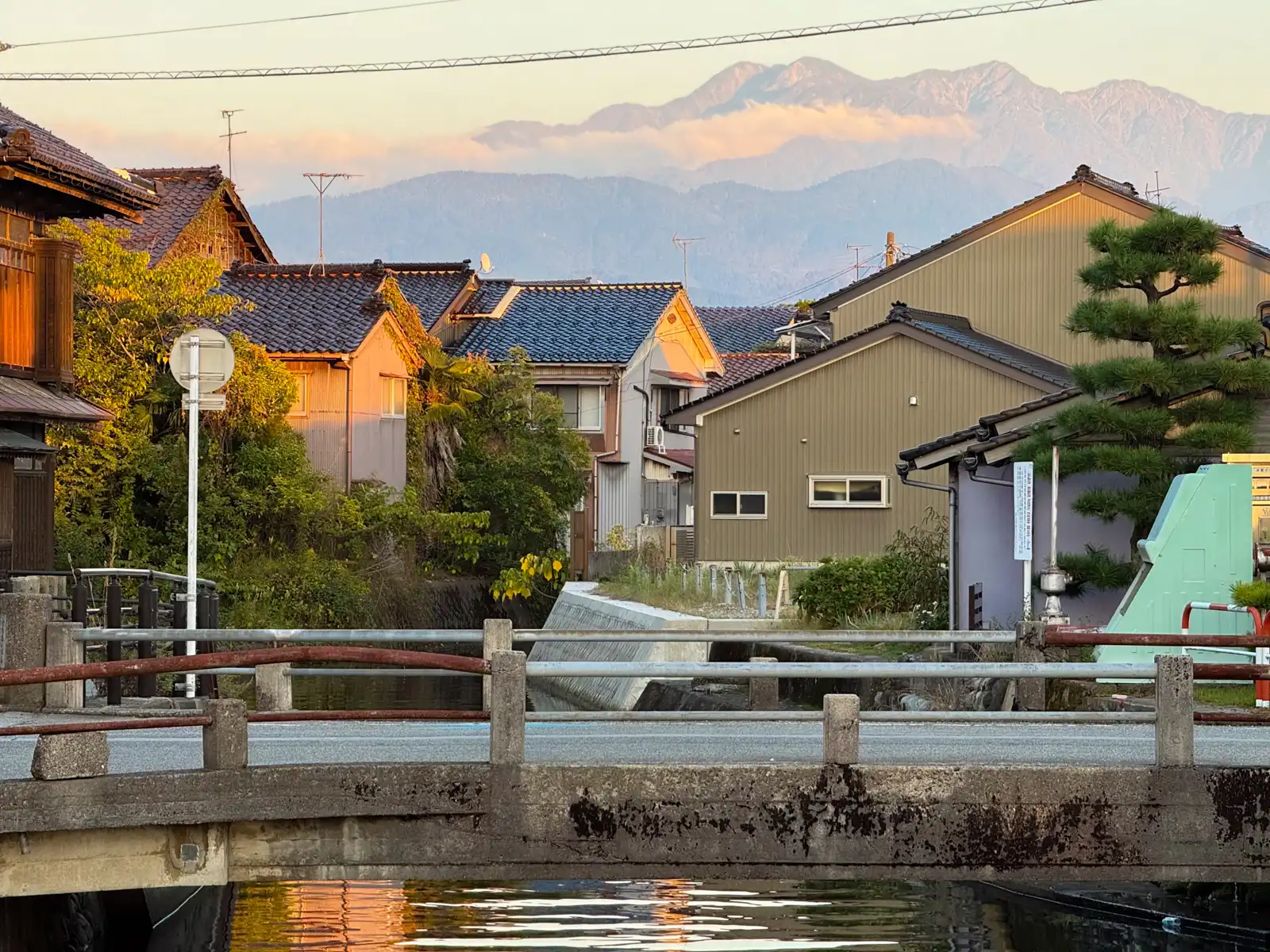
What really surprised me, though, was how quiet everything was. I rode through town after town, and they were almost completely silent. Once in a while I’d see someone walking a dog, but most of the time there was nobody around at all. No voices, no music, nothing except the occasional car going by. To be fair, plenty of places in Japan are like this once you get away from the big cities, but after so many years in Tokyo, that kind of silence almost feels like a sound of its own.
It was already getting dark by the time I reached Toyama City. My hotel was near the station, right in the middle of town, and yet to get there I ended up riding along little side roads cutting through rice fields, which felt a bit funny for a city of around 400,000 people. Compared to Tokyo, Toyama is really spread out. Even fairly close to the center it still feels a lot like the countryside, and it’s only around the station that the tall buildings start to bunch together. The station itself is very modern, with little streetcars running right underneath the elevated Shinkansen tracks. Since 2020 they’ve linked the tram lines on both sides of the station, which apparently made Toyama the first place in Japan where trams run into the space under a Shinkansen station.
My home for the next two nights was a simple business hotel, small but perfectly fine. Once I’d checked in, I went out to find some dinner. Now, at the end of Day Three I said I suspected another Gusto was already waiting for me somewhere in Toyama. Well, I’m happy to report I was wrong. I went to Saizeriya. Yes, it’s another family restaurant chain, and no, I don’t think that counts as a huge change, but it’s progress.
The Beast did a great job that day, too. After about 130 kilometers it still had around 40 percent of its battery left, which is what a day that’s mostly downhill and flat will do for you. The forecast for the next day said rain from morning till night, which is why I’d booked two nights here. The plan for the next day, if you could even call it a plan, was to find a café, most likely a Starbucks, and spend some time fiddling with my MacBook or something until the rain was over. After the longest day of the trip so far, I think the Beast and I had earned a day off.